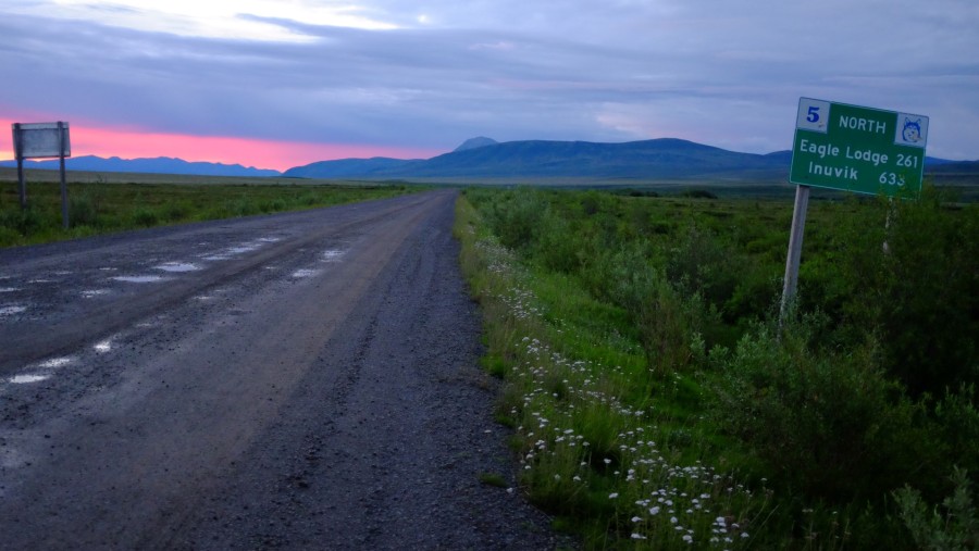
For the past few weeks, I’ve been in the Northwest Territories studying the new highway being constructed between Inuvik and Tuktoyaktuk. Work on the road began under Prime Minister Stephen Harper in 2013, and it should be completed by October 2017. Once all of the “furniture is put on the road” – that’s to say, all the speed limits, interpretive signs, and so forth” – the highway will open, becoming North America’s only public road to the Arctic Ocean. The Dalton Highway in Alaska only reaches so far as the southern limits of Deadhorse before becoming an oil-company-only access road to the North Slope.
In Tuktoyaktuk, a hamlet of a little under 900 residents whose economy has been in the doldrums since the oil boom ended in the 1980s, people are hoping the new road will bring more tourists while lowering the price of groceries and fuel. Others are worried about the road’s impacts on the crystal-clear lakes it passes as it winds up from Inuvik, a government center of 3,000 people, to Tuktoyaktuk (called “Tuk” by locals), on the shores of the Arctic Ocean. Many from Tuk spend the long summer days fishing (or, during the frigid winters, ice fishing) in the Husky Lakes, as they’re called, catching trout and other types of much-needed protein in a place where milk costs upwards of $10 a jug.
The Inuvik-Tuk Highway (ITH) will extend the more famous road that currently terminates in Inuvik: the Dempster Highway. This 740-kilometer long gravel-surfaced road bears the nickname “The Road to Resources.” That’s because the road was originally approved in 1958 by newly elected Prime Minister John Diefenbaker, who envisioned opening up the North to resource development via the building of roads. The Dempster Highway was conceived of as providing year-round access to the rich oil and gas resources in the Mackenzie Delta, where surveying and exploration had begun the year before.
After about twenty years, the highway was finally completed. The discovery and development of oil and gas resources next door in Alaska in the early 1970s gave the Canadian government the impetus it needed to jump start the project, which had been put on hold in 1961 after just three years of construction due to political infighting between the federal and territorial governments. The Canadian government’s desire to display sovereignty in its northwest Arctic played a major role in building the Dempster, just as it does today in extending the highway to the shores of the Northwest Passage, where outwardly signifying Canada’s sovereignty was high on Harper’s agenda.
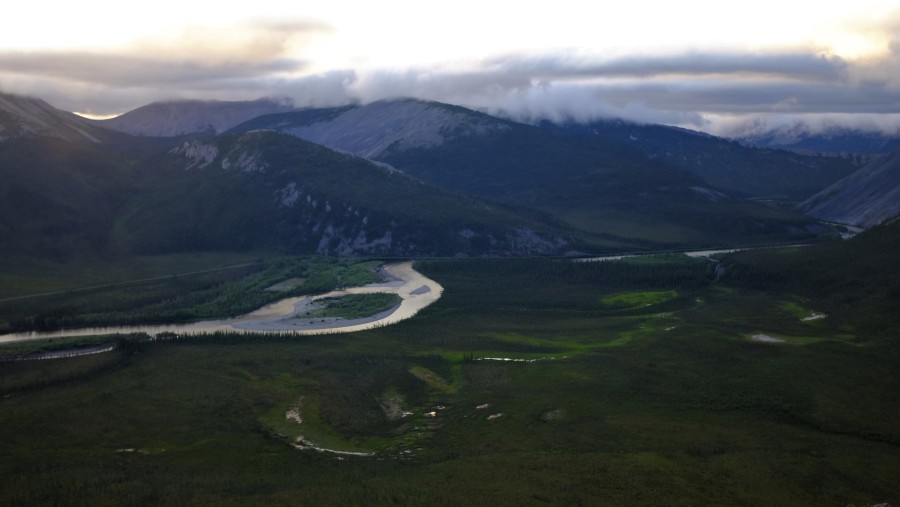
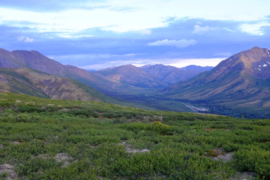
Traveling the Dempster – a mix of gravel, mud, culverts, and potholes which together represent the challenges of road engineering and design in a permafrost-laden environment – gave me a grasp of the vastness and richness of Canada’s North. The irony is that I wouldn’t have been able to see these spaces without the road, but the road has also permanently altered the communities and environment along and around it in ways both good and bad. As one person in Inuvik remarked about the forthcoming ITH to me, “It’s progress, right,” while another person in Tuk commented that the new highway, which will allow permanent, year-round access, will bring “more drugs and alcohol, certainly, but that’s part of growing.”
I traveled the Dempster in the opposite direction of most visitors, heading south from Inuvik all the way to Tombstone Territorial Park and then back up to the North. Most people climb up the road in their RVs, Ford F-150s, or motorcycles beginning in Dawson. (I also spied a couple of avid bicyclists starting out from Inuvik and making their way down to Brazil, mirroring the “Antipodes Expedition” from Ushuaia, Argentina to Inuvik in 2004.)
I’ll write more about my experiences along the Dempster and the ITH in the coming days and weeks, but because time is short and I have my fieldwork to get back to, for now, here are a few snapshots from the road, quite literally.


Great pics!